Monday, 16 March 2015
Thursday, 20 June 2013

Friday, 17 May 2013
The Geology of Britain

Peter Toghill (2000) Crowood Press
This was the book which started it all off for me. I read this book back in 2005 and all the references to diagrams from S236 Historical Geography from the Open University sent me straight through their (virtual!) doors. This book suffers from the same problem as a lot of geology books in that it sometimes reads like a shopping list. That aside it is a good overview of British geology.
Tuesday, 23 April 2013
OUGS - Castleton
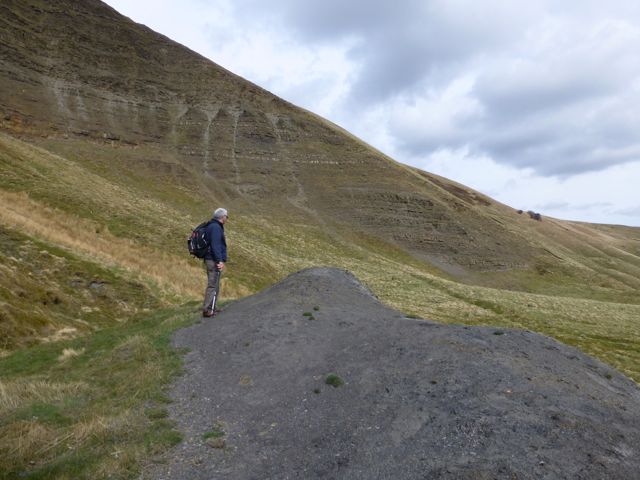
The Yorkshire Branch trip to Castleton was led by Tony Felski on a fine and dry day with only myself and 3 others attending. This made for an intimate and friendly group. We met by the bus stop at the Blue John Cavern at 10 and started by looking at Mam Tor.
To the right, the main part of Mam Tor are the Mam Tor beds which are turbidite sequences, part of the Millstone Grit series. To the left are the Edale Shales which are older and lie directly on the limestone (below).
Building the road on top of the Edale Shales was probably the main reason that it slipped beyond repair. The landslip is still active today and we saw the front of the landslip later.
From here we walked down the old road to Odin Gorge. Here a large lead vein was mined at the surface.

Near the Odin Mine crushing circle is the front of the landslip.
Around these area small pieces of Blue John, galena and baryte can still be found.
Walking from Castleton towards Winnats Pass we saw lava and beach beds.
On the way the sun was shining so I took this view up Winnats Pass earlier in the day.
We walked up the reef observing the change in dip. The beach beds (aka Apron Reef) had a dip of about 25 degrees while the forereef was 35 degrees. The slope evened out at the reef top and sloped backward in the back reef. Finally in the lagoon the beds are flat, although they are mostly covered in sediment now.
The final stop was at Windy Knoll where we saw algal deposits, bitumen and a neptunian dyke.
 |
| View of the ridge |
 |
| Mam Tor |
 |
| Close up of turbidite sequences |
To the right, the main part of Mam Tor are the Mam Tor beds which are turbidite sequences, part of the Millstone Grit series. To the left are the Edale Shales which are older and lie directly on the limestone (below).
 |
| Edale Shale |
Building the road on top of the Edale Shales was probably the main reason that it slipped beyond repair. The landslip is still active today and we saw the front of the landslip later.
 |
| Old road |
From here we walked down the old road to Odin Gorge. Here a large lead vein was mined at the surface.

Near the Odin Mine crushing circle is the front of the landslip.
 |
| Front of landslip |
Around these area small pieces of Blue John, galena and baryte can still be found.
Walking from Castleton towards Winnats Pass we saw lava and beach beds.
 |
| Lava |
 |
| Beach beds in the Speedwell Mine carpark |
 |
| Front of reef |
On the way the sun was shining so I took this view up Winnats Pass earlier in the day.
 |
| What a view! |
We walked up the reef observing the change in dip. The beach beds (aka Apron Reef) had a dip of about 25 degrees while the forereef was 35 degrees. The slope evened out at the reef top and sloped backward in the back reef. Finally in the lagoon the beds are flat, although they are mostly covered in sediment now.
The final stop was at Windy Knoll where we saw algal deposits, bitumen and a neptunian dyke.
 |
| Algal deposits form the reef |
 |
| Now you see it, now you don't. A Neptunian Dyke. |
 |
| Another great view! |
 |
| Bitumen at the top of the knoll |
Thursday, 11 April 2013
Northern England (Regional Geology Guides) Fifth Edition

No look at the geology of the Peak District is complete without looking at the associated geology of northern England. This is the newest of the Regional Geology Guides and is crammed full with colour pictures and rainbow coloured sections and sequences. Like the other guides it's not one to read cover to cover - a veritable phone book of names, stick to the introductory bits. The Carboniferous is well represented in Northumberland so this is the most relevant chapter to the Peak District.
Monday, 8 April 2013
Scarp slopes in the snow

Snow has picked out the scarp slopes looking from the western end of Millstone Edge towards Higger Tor.


Subscribe to:
Posts (Atom)